


Voting Districts not defined, York County, Maine
About
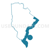
Outline

Summary
| Unique Area Identifier | 591713 |
| Name | Voting Districts not defined |
| County | York County |
| State | Maine |
| Area (square miles) | 231.20 |
| Land Area (square miles) | 0.00 |
| Water Area (square miles) | 231.20 |
| % of Land Area | 0.00 |
| % of Water Area | 100.00 |
| Latitude of the Internal Point | 43.14896550 |
| Longtitude of the Internal Point | -70.52449390 |
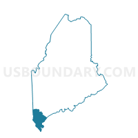
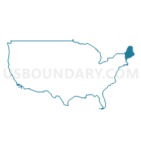
Maps
Graphs
Select a template below for downloading or customizing gragh for Voting Districts not defined, York County, Maine


Neighbors
Neighoring Voting District (by Name) Neighboring Voting District on the Map
- Voting District 011495, York County, ME
- Voting District 011505, York County, ME
- Voting District 011515, York County, ME
- Voting District 021475, York County, ME
- Voting District 021495, York County, ME
- Voting District 041372, York County, ME
- Voting District 041412, York County, ME
- Voting District 051323, York County, ME
- Voting District 051333, York County, ME
- Voting District 061272, Cumberland County, ME
- TOWN OF NEW CASTLE Voting District, Rockingham County, NH
- TOWN OF RYE Voting District, Rockingham County, NH
- Voting Districts not defined, Rockingham County, NH
- Voting Districts not defined, Cumberland County, ME
Top 10 Neighboring County Subdivision (by Population) Neighboring County Subdivision on the Map
- Biddeford city, York County, ME (21,277)
- Scarborough town, Cumberland County, ME (18,919)
- Saco city, York County, ME (18,482)
- York town, York County, ME (12,529)
- Kennebunk town, York County, ME (10,798)
- Wells town, York County, ME (9,589)
- Kittery town, York County, ME (9,490)
- Old Orchard Beach town, York County, ME (8,624)
- Rye town, Rockingham County, NH (5,298)
- Kennebunkport town, York County, ME (3,474)
Top 10 Neighboring Place (by Population) Neighboring Place on the Map
- Biddeford city, ME (21,277)
- Saco city, ME (18,482)
- Old Orchard Beach CDP, ME (8,624)
- Kittery Point CDP, ME (1,012)
Top 10 Neighboring Elementary School District (by Population) Neighboring Elementary School District on the Map
Top 10 Neighboring Unified School District (by Population) Neighboring Unified School District on the Map
- Regional School Unit 23, ME (29,071)
- Biddeford, ME (21,277)
- Scarborough, ME (18,919)
- Regional School Unit 21, ME (18,294)
- York, ME (12,529)
- Wells-Ogunquit Community School District, ME (10,481)
- Kittery, ME (9,490)
- School District Not Defined (Water), NH (0)
Top 10 Neighboring State Legislative District Lower Chamber (by Population) Neighboring State Legislative District Lower Chamber on the Map
- State House District 141, ME (8,854)
- State House District 137, ME (8,764)
- State House District 133, ME (8,659)
- State House District 132, ME (8,624)
- State House District 127, ME (8,504)
- State House District 149, ME (8,487)
- State House District 147, ME (8,361)
- State House District 151, ME (7,954)
- State House District 150, ME (7,698)
- State House District 18, Rockingham County, NH (6,266)
Top 10 Neighboring State Legislative District Upper Chamber (by Population) Neighboring State Legislative District Upper Chamber on the Map
- State Senate District 24, NH (53,314)
- State Senate District 6, ME (40,612)
- State Senate District 2, ME (40,272)
- State Senate District 5, ME (39,097)
- State Senate District 4, ME (37,579)
- State Senate District 1, ME (36,335)
- State Senate Districts not defined, ME (0)
Top 10 Neighboring 111th Congressional District (by Population) Neighboring 111th Congressional District on the Map
Top 10 Neighboring Census Tract (by Population) Neighboring Census Tract on the Map
- Census Tract 280.02, York County, ME (7,412)
- Census Tract 360.01, York County, ME (6,891)
- Census Tract 380.01, York County, ME (6,107)
- Census Tract 173.04, Cumberland County, ME (6,083)
- Census Tract 360.02, York County, ME (5,638)
- Census Tract 710, Rockingham County, NH (5,298)
- Census Tract 61.01, York County, ME (5,290)
- Census Tract 340.01, York County, ME (5,129)
- Census Tract 697, Rockingham County, NH (3,519)
- Census Tract 270, York County, ME (3,474)
Top 10 Neighboring 5-Digit ZIP Code Tabulation Area (by Population) Neighboring 5-Digit ZIP Code Tabulation Area on the Map
- 04005, ME (23,146)
- 04074, ME (18,760)
- 04072, ME (18,482)
- 04043, ME (10,810)
- 03909, ME (9,738)
- 04090, ME (9,589)
- 04064, ME (8,212)
- 04046, ME (7,496)
- 03902, ME (2,211)
- 03905, ME (1,780)